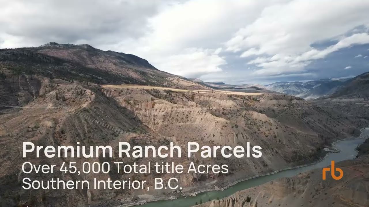
Drone & Field Capture
Aerial photography and video, ground photography, panoramic imagery, site documentation, georeferenced photographs and field observations.
TECHNICAL SERVICES
Help people understand the property, project or asset without needing to be there.
C5 Projects combines professional video, focused project websites, interactive online mapping, mapped land virtual tours, floor plans and building virtual tours for land, commercial, industrial and resource projects.
A PRACTICAL TOOLKIT
A video can explain an asset quickly. A focused project website gives the story a credible home. An interactive map puts it in geographic context. Panoramic imagery can create a virtual site visit. Floor plans and building tours document the space itself.
These services can stand on their own or work together as part of a larger property, project or GeoIntelligence package.
01 · PROPERTY & INDUSTRIAL VIDEO
C5 Projects produces professional video for commercial properties, industrial assets, land and resource projects.
Our approach combines strong visual production with an understanding of land, infrastructure and complex physical assets. The objective is not simply attractive footage. It is to help a buyer, investor, stakeholder or decision-maker quickly understand what they are looking at and why it matters.
Production can combine ground-based video, aerial imagery, photography, graphics and mapping to establish both detail and geographic context.
02 · PROJECT WEBSITES & DIGITAL EXPERIENCES
C5 Projects develops focused websites and digital experiences for land, resource, commercial and industrial projects.
This is not generic web design. We build the presentation layer around the asset itself, combining clear project information with mapping, imagery, technical graphics, documents and media so the audience can understand both the story and the underlying project.
A project site can stand alone as a focused landing page or become the front end for interactive maps, virtual tours, investor information and other technical material.
03 · INTERACTIVE MAPPING
A conventional map shows where something is. A well-designed interactive map lets people explore the project for themselves.
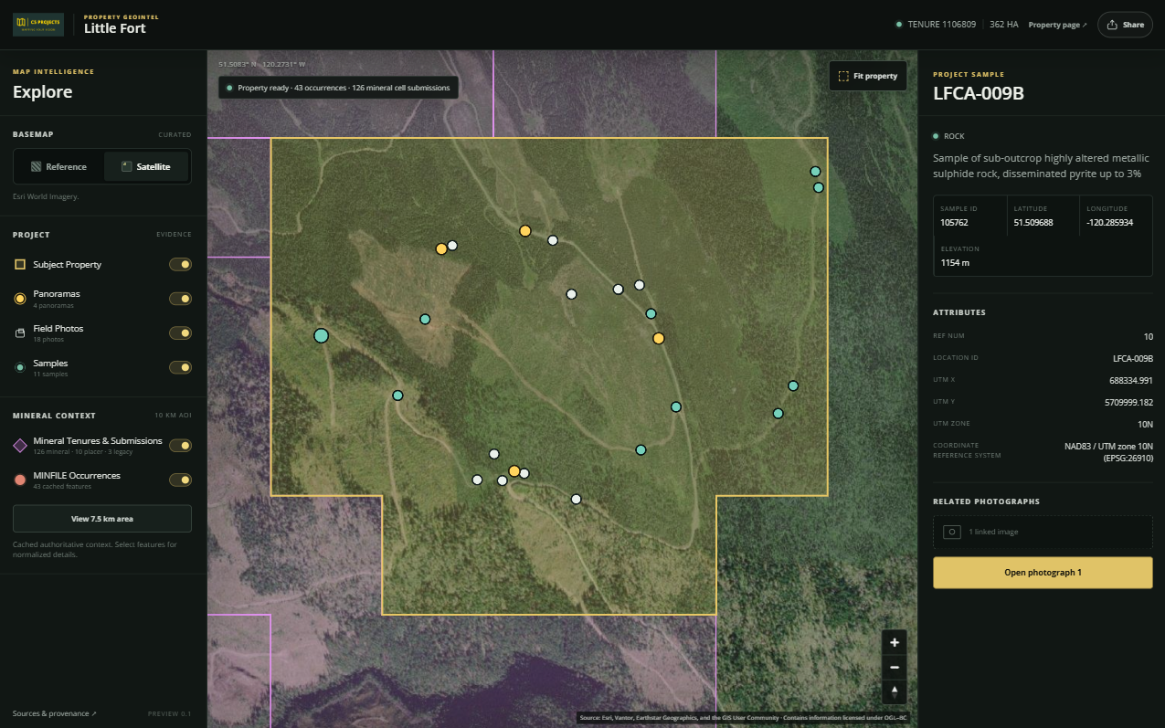
C5 Projects develops browser-based mapping experiences that can bring together property boundaries, satellite imagery, roads, infrastructure, terrain, land interests, mineral tenure, geology, field observations, photographs, panoramic imagery and other project-specific information.
The result can be as simple as an interactive property map or as sophisticated as a dedicated GeoIntelligence environment. No specialized GIS software is required.
04 · LAND VIRTUAL TOURS
Large properties are difficult to communicate through conventional photography. A photograph may show what the land looks like, but it often leaves the viewer wondering where it was taken and which direction they are looking.
C5 Projects creates map-based virtual tours using panoramic imagery captured at strategic locations throughout a property.
Each panorama is plotted at its actual location on an interactive map. When the panorama is opened, the map indicates the camera location, viewing direction and field of view. As the user looks around, the mapped view changes with them.
Users can move between observation points and relate what they see directly to property boundaries, roads, infrastructure, terrain and other mapped information.
A virtual site visit with geographic context.
Well suited to resource properties, development land, large rural holdings, industrial sites, infrastructure projects, remote properties, due diligence and investor presentations.
Experience the live demo05 · FLOOR PLANS & BUILDING VIRTUAL TOURS
C5 Projects provides floor-plan documentation and virtual tours for commercial and industrial properties.
Floor plans give owners, buyers, tenants and project teams a straightforward way to understand a building's physical layout. Building virtual tours add another dimension by allowing people to move through the property remotely and see individual spaces in context.
Together, floor plans, photography and virtual tours create a practical digital record of a physical property.
SUPPORTING CAPABILITIES
Aerial photography and video, ground photography, panoramic imagery, site documentation, georeferenced photographs and field observations.
GIS mapping, property and site maps, spatial data preparation, technical exhibits, project graphics, imagery preparation and custom technical deliverables.
ONE PROPERTY · MULTIPLE VIEWS
A resource property might combine a focused project website with an interactive map, panoramic observation points, drone imagery, project video, tenure information and field observations. A commercial or industrial property might combine professional video, a project landing page, floor plans, photography, aerial imagery and a building virtual tour.
Because these capabilities are produced within the same technical workflow, they can work together as one coherent project rather than a collection of disconnected files.
YOUR PROJECT
Tell us about the property, site or project and the audience you need to reach. We can recommend a straightforward deliverable or combine several capabilities into a larger project.